wharves
1,261 photos and 2 illustrations tagged wharves, from 16 members of Flickr Commons.
When were these photos & illustrations taken?
Where were these photos & illustrations tagged?
5% of these photos & illustrations are geotagged.
Related tags
Tags that often appear on the same photos & illustrations:
- portsharbours
- vesseltype
- construction
- industries
- aucklandharbourboard
- cargo
- commercialshipping
- harbourboards
- environment
- steamvessel
- cargoship
- sydney
- yacht
- rail
- landtransport
- piers
- royalnavyrn
- sydneyharbour
- wharf
- ships
- tug
- harbour
- crane
- technology
Members using this tag
- New Zealand Maritime Museum Hui Te Ananui A Tangaroa
- SMU Libraries Digital Collections
- Australian National Maritime Museum on The Commons
- Museums of History NSW - State Archives Collection
- New York Public Library
- State Library of Queensland
- State Library of New South Wales
- Royal Australian Historical Society
- Deseronto Archives
- Florida Memory
- Powerhouse Museum
- British Library
Photos & Illustrations
Show photos & illustrations photos (1,261) illustrations (2)
A selection of photos & illustrations tagged wharves:
Loading photos & illustrations…
Recent uploads
The last upload was 6 days ago.
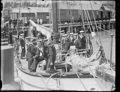
Crew on RNVR DEVERON, Lyttelton wharf from New Zealand Maritime Museum Hui Te Ananui A Tangaroa uploaded 6 days ago

HMS VERONICA (1915) from New Zealand Maritime Museum Hui Te Ananui A Tangaroa uploaded 6 days ago

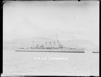
HMAS CANBERRA (1927) on Lyttelton Harbour from New Zealand Maritime Museum Hui Te Ananui A Tangaroa uploaded 6 days ago

HMAS CANBERRA (1927) on Lyttelton Harbour from New Zealand Maritime Museum Hui Te Ananui A Tangaroa uploaded 6 days ago

Heavy cruiser HMAS AUSTRALIA on Lyttelton Harbour from New Zealand Maritime Museum Hui Te Ananui A Tangaroa uploaded 6 days ago
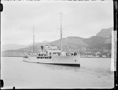
HMS LEITH (1934) Naval vessel, Lyttelton Harbour from New Zealand Maritime Museum Hui Te Ananui A Tangaroa uploaded 6 days ago

HMS LEITH (1934) naval vessel, Lyttelton Harbour from New Zealand Maritime Museum Hui Te Ananui A Tangaroa uploaded 6 days ago

Coastal settlement and pier [Great Britain] from New Zealand Maritime Museum Hui Te Ananui A Tangaroa uploaded 6 days ago

Coastal settlement and pier [Great Britain] from New Zealand Maritime Museum Hui Te Ananui A Tangaroa uploaded 6 days ago

RANGITIKI (1929) passenger - cargo ship from New Zealand Maritime Museum Hui Te Ananui A Tangaroa uploaded 6 days ago

CAMBRIDGE (1937) from New Zealand Maritime Museum Hui Te Ananui A Tangaroa uploaded 6 days ago

TAMAROA (1922) from New Zealand Maritime Museum Hui Te Ananui A Tangaroa uploaded 6 days ago

TAMAROA (1922) from New Zealand Maritime Museum Hui Te Ananui A Tangaroa uploaded 6 days ago

Conversations
Here’s a selection of the conversations happening on these photos & illustrations:
HMAT BORDA berthing at Millers Point

- Andy Brill said:
- beachcomber australia said:
- Australian National Maritime Museum on The Commons said:
Two ships moored at Auckland Creek wharves, Gladstone, ca. 1869

-
Vesna Verencevic said:
Gladstone was originally known as Port Curtis, which was named by Matthew Flinders in 1802 after Sir Roger Curtis who had been Commandant at the Cape of Good Hope when he had called there for victuals and resupply. Port Curtis enjoyed a brief three months of temporary settlement as the administrative centre of the colony of North Australia (1847). George Barney (Barney's Point, Gladstone) commanded the settlement but a change of government in England led to its disbandment. Within a few years pastoral occupation of the hinterland brought about pressure for the port to be a livestock shipping outlet. In 1853 the town of Gladstone was surveyed and the first sale of town and suburban allotments took place the following year. Gladstone served well as a harbor, but the absence of plentiful water and agricultural land hindered its development. A gold rush at nearby Canoona (1858) then overshadowed Gladstone for a period. Although declared a municipality in 1863, Gladstone's growth was slow: a customs house was erected in 1860, the first school in 1864, a Presbyterian church in 1869 and Catholic and Church of England churches in 1874. Gladstone's wharves were at Auckland Point (named after the ship Lord Auckland that brought the first European settlers in 1847), where Auckland Inlet enters Port Curtis. The short waterway involved navigating a strait that was obstructed by submerged rock and passable only at high tide. Intermittent blasting and dredging went on until the 1890s in an attempt to improve access through the passage, with less than adequate results. Funds were spent on alternative harbors at Port Alma and Rockhampton, leaving Gladstone's population convinced they were being unfairly overlooked. Gladstone remained convinced that it had the best potential shipping harbour in central Queensland. The state government appointed the Gladstone Harbour Board in 1914, and the town formed its own Gladstone Harbour League to lobby the Railways minister for fairer haulage rates and for freight from surrounding shires. Progress was slow, and the town's economic mainstays remained the Port Curtis dairy factory (which achieved maximum production during the 1940s-50s) and the meat works. Tourism was still a distant prospect, although Heron Island emerged as a local holiday destination in the 1930s. Flying boats, bound for Singapore and connections to England called at Auckland Inlet from 1935 and a land aerodrome, jointly backed by Gladstone and Calliope Shire, opened in 1956. Source: www.queenslandplaces.com.au/gladstone
SS MEDIC departing Dalgetty's wharf at Millers Point

-
beachcomber australia said:
That rings a ship's bell! ... see comments and research etc ...

-
Australian National Maritime Museum on The Commons said:
beachcomber australia Thanks Beachcomber, this must be the same day. We are interested in identifying the steam yacht at front (TBC). What a fascinating story re Lightoller & his Boer War 'prank'!
-
beachcomber australia said:
Australian National Maritime Museum on The Commons The State Records NSW catalogue says the steam yacht at front is the "NSW Government Steam Launch PREMIER". Unfortunately the captions for Series 4481 are notoriously unreliable, or perhaps fortunately because it has meant a lot of flickr fun for sleuths. A quick browse around Trove looks like this particular ID might be true.
-
beachcomber australia said:
Arrival 8/5/1903 - trove.nla.gov.au/ndp/del/article/113417106 - this photo Departure 22/5/1903 (4 pm) - trove.nla.gov.au/ndp/del/article/14570708