rocks
451 photos and 33 illustrations tagged rocks, from 42 members of Flickr Commons.
When were these photos & illustrations taken?
Where were these photos & illustrations tagged?
30% of these photos & illustrations are geotagged.
Related tags
Tags that often appear on the same photos & illustrations:
- xmlns:dc=httppurlorgdcelements11
- water
- trees
- waterfall
- powerhousemuseum
- landscape
- river
- queensland
- libraryofcongress
- beach
- sea
- boulders
- mountain
- publicdomain
- ocean
- nationallibraryofireland
- bldigital
- men
- man
- mechanicalcurator
- mountains
- statelibraryofqueensland
- rivers
- bibliothèquedetoulouse
Members using this tag
- State Library of Queensland
- Powerhouse Museum
- The Library of Congress
- Community Archives of Belleville & Hastings County
- SMU Libraries Digital Collections
- National Library of Ireland on The Commons
- British Library
- Bibliothèque de Toulouse
- Keene Public Library and the Historical Society of Cheshire County
- Miami University Libraries - Digital Collections
- State Library of New South Wales
- Royal Australian Historical Society
Photos & Illustrations
Show photos & illustrations photos (451) illustrations (33)
A selection of photos & illustrations tagged rocks:
Loading photos & illustrations…
Recent uploads
The last upload was April 2026.

2026-033-07-01 from Community Archives of Belleville & Hastings County uploaded April 2026

Harry McCallaum and friends standing on rocks at a beach in Coolangatta ca. 1946 from State Library of Queensland uploaded September 2025

Viking Phase III from NASA on The Commons uploaded November 2024

Granite rocks dwarfing the landscape Stanthorpe c.a 1910 from State Library of Queensland uploaded January 2024

Living dangerously while trying to catch a fish Queensland ca. 1916 from State Library of Queensland uploaded January 2024

Man standing on a wooden bridge at the Somerset Dam construction site in Queensland, ca. 1935 from State Library of Queensland uploaded September 2023

Group of people on a wooden pier in South East Queensland, ca 1945 from State Library of Queensland uploaded September 2023

Waves breaking on rocks at Coolangatta, 1923 from State Library of Queensland uploaded July 2023

The prize? A sticky bun with extra toffee!!! from National Library of Ireland on The Commons uploaded July 2023

Claro, ¿cuál es el punto? from National Library of Ireland on The Commons uploaded June 2023

Miners at the gold diggings outside Charters Towers, ca. 1878 from State Library of Queensland uploaded February 2023
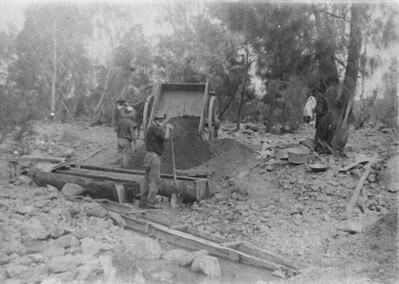
Gold mining on Mount Leyshon near Charters Towers, ca. 1882 from State Library of Queensland uploaded February 2023

Ambulance building at Townsville, ca. 1908 from State Library of Queensland uploaded February 2023

Two little girls at Kissing Point beach Townsville, 1949 from State Library of Queensland uploaded February 2023

Conversations
Here’s a selection of the conversations happening on these photos & illustrations:
Claro, ¿cuál es el punto?
- 15 older comments, and then…
- O Mac said:
- beachcomber australia said:
- beachcomber australia said:
- National Library of Ireland on The Commons said:
- beachcomber australia said:
Mount Monadnock in Cheshire County, New Hampshire

-
JT Nous said:
Super picture. Mass of rock, success
Flat Top Island outside Mackay, ca. 1874

-
Vesna Verencevic said:
Flat Top Island, is a small island off the entrance to Mackay harbor at the mouth of Pioneer River, about 6.5 kilometers (4.0 mi) east of Mackay, Queensland, Australia. It used to mark the river entrance for shipping and the direction of the port, as well as highlighting close-by shoals at Shoalwater Point and a reef off Hay Point. Flat Top Island Light is an inactive lighthouse located on Flat Top Island. At 6 meters (20 ft) from the ground to the lantern floor, it is the shortest of Queensland's timber-framed iron-clad lighthouses. In January 1918 the lighthouse was the only structure on the island and the only aid to navigation to survive the 1918 Mackay cyclone.[12] The lighthouse was automated around 1920. In 1991, the light source was still an open flame acetylene gas burner.[13] The light was discontinued in March 2007[14] and it is currently conserved on site.[15] The last light characteristic displayed was four flashes every twenty seconds, red and white depending on the direction. The lighthouse is currently inactive. Before that, it was operated by the Australian Maritime Safety Authority. The island is accessible only by boat. It is unclear whether public access to the site and tower are available. Source: en.wikipedia.org/wiki/Flat_Top_Island_Light
-
Peter Robo said:
Surely there must be someone in Mackay, a group or organization who would be interested in taking custodianship for this unique piece of history... Insitu restoration or relocation to Mackay as a tourist attraction!