millersroad
3 photos tagged millersroad, from 1 member of Flickr Commons.
When were these photos taken?
Where were these photos tagged?
None of these photos are geotagged.
Related tags
Tags that often appear on the same photos:
- therocks
- blackandwhite
- pub
- archives
- newsouthwales
- staterecordsnsw
- millerspoint
- people
- sydney
- hotels
- shopkeeper
- bootmaker
- kentstreet
- captaincookhotel
- street
- kent
- royaloak
- clydestreet
- staterecordsnswnewsouthwalesblackandwhite
- dog
- hotel
- hartstreet
Members using this tag
Photos
Photos tagged millersroad:
Loading photos…
Recent uploads
The last upload was September 2011.

Captain Cook Hotel, c.1888 from Museums of History NSW - State Archives Collection uploaded September 2011

Millers Road, The Rocks from Museums of History NSW - State Archives Collection uploaded August 2011

Captain Cook Hotel, The Rocks from Museums of History NSW - State Archives Collection uploaded August 2009
Conversations
Here’s a selection of the conversations happening on these photos:
Millers Road, The Rocks
- 16 older comments, and then…
- beachcomber australia said:
- pellethepoet said:
- pellethepoet said:
- Mich said:
- beachcomber australia said:
Captain Cook Hotel, The Rocks
- 3 older comments, and then…
-
beachcomber australia said:
The Captain Cook Hotel swallowed Mr J. Boyce's store and gave him the boot! Google street view: maps.google.com.au/maps?q=-33.860765,151.208045&sll=-...
-
Museums of History NSW - State Archives Collection said:
It sure did. We're hoping to upload some more images of shops soon - it'll be interesting to see what's become of them.
-
abounding interest said:
It was torn down in the 1920s and this went up in its place.

-
Rhettt said:
Pretty sure that's the same building. Just with a new facade - the windows are all in the same positioning exactly, as is the divider on the roof. It's merely an update in style or 'facelift.'
-
dunedoo said:
Hi, I'm an admin for a group called Pubs of Australia, and we'd love to have this added to the group!
Captain Cook Hotel, c.1888
-
pellethepoet said:
Museums of History NSW - State Archives Collection Well aren't you just wonderful! We don't even have to ask and you post it ... :) See Miller's Road discussion here -
-
pellethepoet said:
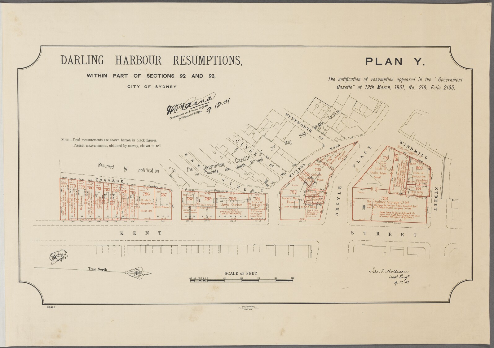
Views down Hart Street, from Miller's Road, to the harbour, by John Henry Harvey - handle.slv.vic.gov.au/10381/50588 [H91.300/372] handle.slv.vic.gov.au/10381/46343 [H91.300/301] See Darling Harbour Resumptions "Plan Y" map (1901) - gallery.records.nsw.gov.au/wp-content/gallery/darling-har...