johnfortunelawrence
144 photos tagged johnfortunelawrence, from 1 member of Flickr Commons.
When were these photos taken?
Where were these photos tagged?
85% of these photos are geotagged.
Related tags
Tags that often appear on the same photos:
- jamessimonton
- frederickhollandmares
- nationallibraryofireland
- stereographicnegatives
- williammervynlawrence
- lawrencephotographcollection
- stereopairsphotographcollection
- stereopairs
- locationidentified
- ireland
- ulster
- northernireland
- church
- thestereopairsphotographcollection
- bridge
- countyantrim
- munster
- river
- leinster
- belfast
- trees
- countywicklow
- countydown
- building
Members using this tag
Photos
A selection of photos tagged johnfortunelawrence:
Loading photos…
Recent uploads
The last upload was April 2026.

Rod and gun (and dog) from National Library of Ireland on The Commons uploaded April 2026

Oh where the Shannon River flows from National Library of Ireland on The Commons uploaded November 2025

Am I seeing double once again? from National Library of Ireland on The Commons uploaded November 2025

Where in the Wilds o' Wickla? from National Library of Ireland on The Commons uploaded October 2025

Belfast Indemnity Bill from National Library of Ireland on The Commons uploaded September 2023

Burglars beware - we've got you covered! from National Library of Ireland on The Commons uploaded April 2023

Rocking round the clock from National Library of Ireland on The Commons uploaded November 2022

Polyscopic stereoscopic pictures and stuff like that from National Library of Ireland on The Commons uploaded August 2022

Crossing the Hellespont? Not quite but it is wet! from National Library of Ireland on The Commons uploaded June 2022

The boys - and girls from the Blackstuff from National Library of Ireland on The Commons uploaded November 2021

Whose lights are fled, whose garlands dead! from National Library of Ireland on The Commons uploaded November 2021
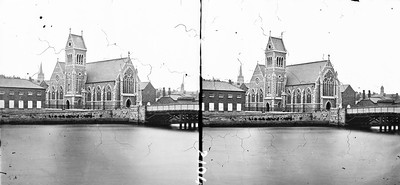
The bridge to church. from National Library of Ireland on The Commons uploaded October 2021

Waiting for Doggo? from National Library of Ireland on The Commons uploaded September 2021

Grimly Gothic Gods Gaff from National Library of Ireland on The Commons uploaded August 2021

High Bridge over the Low Valley from National Library of Ireland on The Commons uploaded July 2021
Conversations
Here’s a selection of the conversations happening on these photos:
Whose lights are fled, whose garlands dead!
- 6 older comments, and then…
- Rory Sherlock said:
- Rory Sherlock said:
- Rory Sherlock said:
- beachcomber australia said:
- beachcomber australia said:
Am I seeing double once again?
- 6 older comments, and then…
-
beachcomber australia said:
Thinking Innisfallen. There are several other stereo pairs there, but I can't find a match for the boathouse. See the distant hills here - catalogue.nli.ie/Record/vtls000564217
-
beachcomber australia said:
Hmmm ...
There is a substantial "Boat House" marked on the 25" map, west of Ross Castle, on Ross Island. About here on the GoogleMapsSatellite which shows nothing - maps.app.goo.gl/kiLUkFwL4qNjBjQM7 -
National Library of Ireland on The Commons said:
beachcomber australia Link not working too well.
-
beachcomber australia said:
National Library of Ireland on The Commons Thanks, fixed above. Nothing to see except trees and rocks. But if you twiddle round into 3D the shape of the hills is similar and the sun is in the right place when looking sout-west.
-
Rory Sherlock said:
I wonder is that the now-lost boathouse just downriver from Lord Brandon's cottage?
Here's a Streetview from the western shore of the Upper Lake, looking west - note the distinctive 'bump' to the left of the cloud-covered mountains - it has a steep step at right and a uniform slope at left, just like the bump to the left of the taller mountains in our boathouse photo.
maps.app.goo.gl/iWWPW7F6Dh9ros1a8
Less than 100m NW of the point where Peng Shi took that panoramic image in 2023 is the site of a boathouse which lies 290m SW of Lord Brandon's Cottage - the boathouse is shown on the Ordnance Survey 6" map (1st edition), but it's just marked as a Quay on the last edition. The boathouse seems to be about 18m long on the first edition map, so it could be the one in the photo.
Rod and gun (and dog)
- 9 older comments, and then…
-
O Mac said:
It was taken, looking north, from beside St Bridget's church at Ballinafad, Co Galway.
maps.app.goo.gl/6Aj2eYcb7TzwsryZA -
National Library of Ireland on The Commons said:
O Mac Well, relieved I don't have to season my hat. But how did you work this out? So the tiny bridge is no more?
-
O Mac said:
National Library of Ireland on The Commons From these photos it would appear that the original bridge exists..
maps.app.goo.gl/YkAfHPW4wT7zdw4e7?g_st=ac
maps.app.goo.gl/PRfttiDiAcZSMVZY7?g_st=ac -
John Spooner said:
It works quite nicely when viewed through the appropriate apparatus - the flora (gorse?) in the foreground stands out from the stones, rocks and gentry, which themselves stand out from the water and mountains in the distance.
-
Suck Diesel said:
I wonder if the small bridge is the location of the present road bridge?
maps.app.goo.gl/XYuBZnT9jTShySpv8