frederickhollandmares
208 photos tagged frederickhollandmares, from 1 member of Flickr Commons.
When were these photos taken?
Where were these photos tagged?
86% of these photos are geotagged.
Related tags
Tags that often appear on the same photos:
- jamessimonton
- nationallibraryofireland
- stereographicnegatives
- lawrencephotographcollection
- stereopairs
- johnfortunelawrence
- williammervynlawrence
- stereopairsphotographcollection
- ireland
- locationidentified
- stereoscopiccollection
- stereoscope
- johnlawrence
- 19thcentury
- ulster
- leinster
- northernireland
- munster
- church
- dublin
- bridge
- river
- thestereopairsphotographcollection
- horses
Members using this tag
Photos
A selection of photos tagged frederickhollandmares:
Loading photos…
Recent uploads
The last upload was April 2026.

Rod and gun (and dog) from National Library of Ireland on The Commons uploaded April 2026

Oh where the Shannon River flows from National Library of Ireland on The Commons uploaded November 2025

Am I seeing double once again? from National Library of Ireland on The Commons uploaded November 2025

Where in the Wilds o' Wickla? from National Library of Ireland on The Commons uploaded October 2025

Belfast Indemnity Bill from National Library of Ireland on The Commons uploaded September 2023

Burglars beware - we've got you covered! from National Library of Ireland on The Commons uploaded April 2023

Rocking round the clock from National Library of Ireland on The Commons uploaded November 2022

Polyscopic stereoscopic pictures and stuff like that from National Library of Ireland on The Commons uploaded August 2022

Crossing the Hellespont? Not quite but it is wet! from National Library of Ireland on The Commons uploaded June 2022

The boys - and girls from the Blackstuff from National Library of Ireland on The Commons uploaded November 2021

Whose lights are fled, whose garlands dead! from National Library of Ireland on The Commons uploaded November 2021
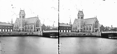
The bridge to church. from National Library of Ireland on The Commons uploaded October 2021

Waiting for Doggo? from National Library of Ireland on The Commons uploaded September 2021

Grimly Gothic Gods Gaff from National Library of Ireland on The Commons uploaded August 2021

High Bridge over the Low Valley from National Library of Ireland on The Commons uploaded July 2021
Conversations
Here’s a selection of the conversations happening on these photos:
Grimly Gothic Gods Gaff
- 13 older comments, and then…
- beachcomber australia said:
- derangedlemur said:
- O Mac said:
- O Mac said:
- beachcomber australia said:
Crossing the Hellespont? Not quite but it is wet!
- 12 older comments, and then…
-
Niall McAuley said:
Dungarvan? Streetview
-
Niall McAuley said:
The railway bridge opened in 1878. Nothing else in the photo survives, I think.
-
beachcomber australia said:
Flickr is sometimes amazing! In 1983 via Neil Smith

-
Sunny Harry said:


-
Niall McAuley said:
Many of these STPs were revisited by Lawrence/French later, but not this one I think.
A Pope's eye view of the city

- 10 older comments, and then…
-
O Mac said:
A good days work.
-
beachcomber australia said:
There are many recent googlesphere panos from up there on the dome. Here is one from 2016 - goo.gl/maps/gSirAE3h51qzCSDA9
-
Sharon Corbet said:
I think this is from the catalogue of Ferrier P. F. & Soulier, J. Levy like the one below:

-
beachcomber australia said:
Flickr sometimes has too many 'nows' to choose from! This one is hi-res, in 2013 via Atilla2008

-
Sharon Corbet said:
The Getty Institute has an entry in their catalogue saying: ZSG2-E1I8.33 Ferrier, Rome, vue prise de la couple de Saint-Pierre Scope and Content Note Numbered in negative: 7270 which would back up the Ferrier connection. In that case it would be likely that the original photo at least is pre-1864, as that's when Léon and Lévy bought the collection of Ferrier et Soulier.