rosskam
4 photos tagged rosskam, from 1 member of Flickr Commons.
When were these photos taken?
Where were these photos tagged?
25% of these photos are geotagged.
Related tags
Tags that often appear on the same photos:
- libraryofcongress
- xmlns:dc=httppurlorgdcelements11
- washingtondc
- washington
- dc
- districtofcolumbia
- historicalphoto
- history
- louiserosskam
- louise
- street
- building
- children
- red
- 1940s
- geo:lat=38874676
- geo:long=77018784
- dc:identifier=httphdllocgovlocpnpfsac1a34424
- car
- corner
- bricks
- cocacola
- grocery
- ad
Members using this tag
Photos
Photos tagged rosskam:
Loading photos…
Recent uploads
The last upload was January 2008.

[Laundry, barbershop and stores, Washington, D.C.?] (LOC) from The Library of Congress uploaded January 2008

[Children in street, Washington, D.C] (LOC) from The Library of Congress uploaded January 2008

[Row houses, corner of N and Union Streets S.W., Washington, D.C.] (LOC) from The Library of Congress uploaded January 2008

Conversations
Here’s a selection of the conversations happening on these photos:
[Laundry, barbershop and stores, Washington, D.C.?] (LOC)
- An Amateur said:
- las.photographs said:
- Instinctive Jar said:
- Steve Rhodes said:
[Shulman's Market at the southeast corner of N Street and Union Street S.W., Washington, D.C., with a 1931 Chevrolet car parked in front] (LOC)
- 6 older comments, and then…
-
perfgeek said:
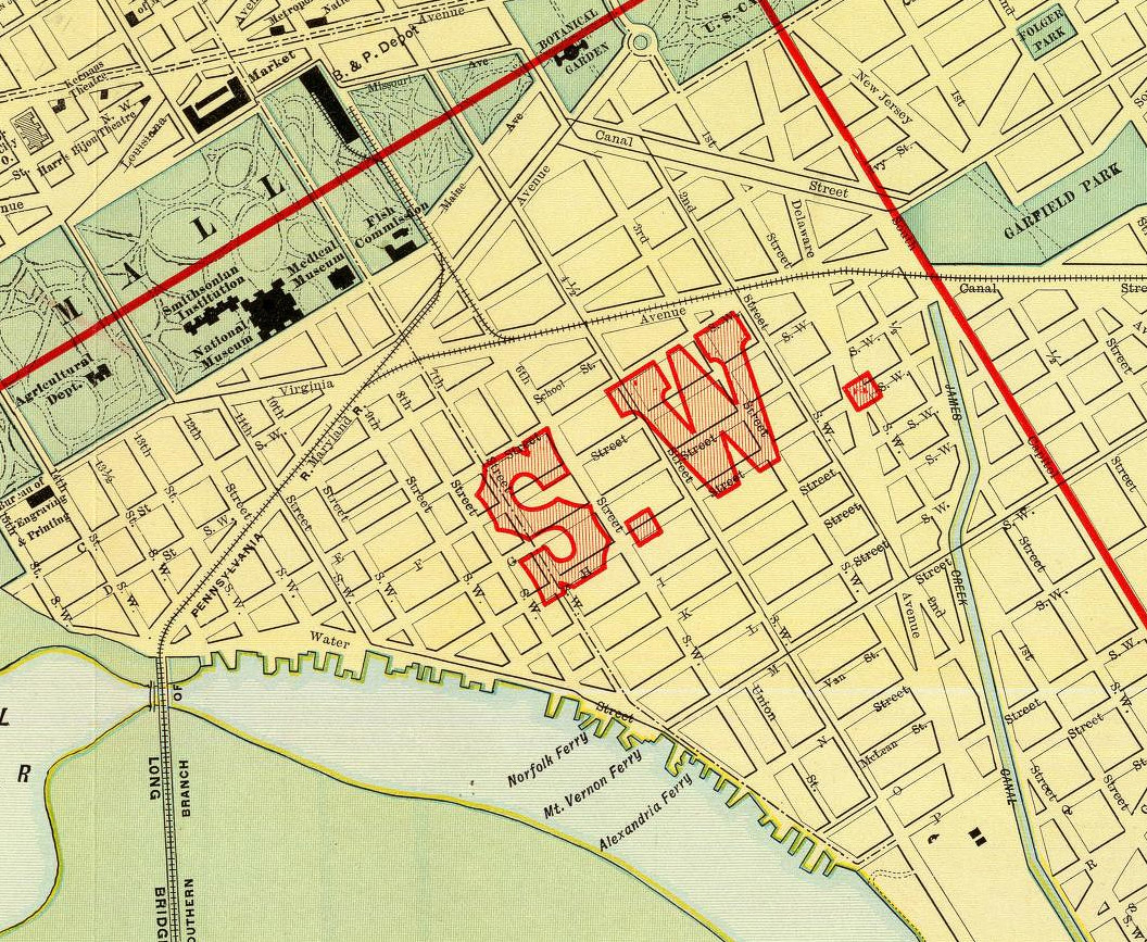
Union Street must have been renamed at some point since there is no Union Street appearing on a contemporary map of DC.
-
rrsafety said:
More discussion of the N street/Union street issue here: elizatruitt.wordpress.com/2007/03/27/anacostia-market/
-
jdavis417 said:
Title: Legal Council
-
iris.schimandle said:
So it was at the SE corner of N and Union (from this great map).
-
Richard Spiegelman said:
The car appears to be a circa 1931 Ford
[Children in street, Washington, D.C] (LOC)
- 9 older comments, and then…
-
Scott S said:
I like the stances they each have. It has a lot to say.
-
Dan4th Nicholas said:
"At N and Union Streets S.W., in Washington, D.C." This one could actually be geotagged!
-
visnyk said:
Interesting engagement. See the largest size; the boys appear to have been discussing their next football play or deciding whether to keep playing or not. Was it autumn? Long shadows...any ideas on time of day?
-
rrsafety said:
"At N and Union Streets S.W., in Washington, D.C" Can't find it on "birdseye" at MSN live maps... Anyone have a better address to try?
-
Scott S said:
@Dan4th & rrsafety: [it appears Union St is long gone, likely eaten up by Ft McNair or some development project...] It looks like iris.schimandle knows where this is.
[Row houses, corner of N and Union Streets S.W., Washington, D.C.] (LOC)
-
perfgeek said:
Is there a corner of N and Union Street in DC?
-
iris.schimandle said:
The corner in question is now the West end of N St. SW , at roughly 38.874676,-77.018784 (found using Google Maps). What used to be Union St. ran perpendicular to that point between M and O Streets. From the satellite images, it doesn't look like any of the buildings remain. Anyone know what that new development is?
-
iris.schimandle said:
Here's the present day satellite photo.
-
shapp snott said:
The area is currently occupied by condos and apartment buildings, none of which are architecturally noteworthy or distinguished. Arena Stage is also located in the general vicinty. Southwest Washington was once alive with people and streetlife. The urban "renewal" of the 1950s and 60s turned the area into a clean but sterile urban wasteland.