battery
61 photos and 22 illustrations tagged battery, from 11 members of Flickr Commons.
When were these photos & illustrations taken?
Where were these photos & illustrations tagged?
6% of these photos & illustrations are geotagged.
Related tags
Tags that often appear on the same photos & illustrations:
- archives
- park
- summer
- halifax
- halifaxregionalmunicipality
- pointpleasantpark
- urbanforest
- containerterminal
- fort
- martello
- blackrockbeach
- naval
- memorial
- wwii
- winter
- cityplanning
- fire
- greenspace
- history
- canada
- novascotia
- bldigital
- publicdomain
- mechanicalcurator
Members using this tag
- Halifax Municipal Archives
- British Library
- The Library of Congress
- SDASM Archives
- Museums of History NSW - State Archives Collection
- Tasmanian Archives and State Library (Commons)
- State Library of New South Wales
- U.S. National Archives
- Australian National Maritime Museum on The Commons
- New York Public Library
- Powerhouse Museum
Photos & Illustrations
Show photos & illustrations photos (61) illustrations (22)
A selection of photos & illustrations tagged battery:
Loading photos & illustrations…
Recent uploads
The last upload was October 2023.

23_0015361 Convair Negative Image from SDASM Archives uploaded October 2023

Gun Battery, SMS Bismarck, 1879 from State Library of New South Wales uploaded November 2022

Leginska (LOC) from The Library of Congress uploaded December 2020

Leginska (LOC) from The Library of Congress uploaded December 2020

Prince of Wales Tower from Halifax Municipal Archives uploaded February 2019

Point Pleasant Park Canteen [fire aftermath] from Halifax Municipal Archives uploaded February 2019

Point Pleasant Park stand built 1881 from Halifax Municipal Archives uploaded February 2019

[Fort Ogilvie Cannon] from Halifax Municipal Archives uploaded February 2019

Point Pleasant Paths from Halifax Municipal Archives uploaded February 2019

Point Pleasant Park from Halifax Municipal Archives uploaded February 2019

Point Pleasant Park from Halifax Municipal Archives uploaded February 2019

Point Pleasant Park from Halifax Municipal Archives uploaded February 2019

Pt. Pleasant Park well from Halifax Municipal Archives uploaded February 2019

West Bandstand Pt Pleasant Park from Halifax Municipal Archives uploaded February 2019

[Point Pleasant Park Battery in winter] from Halifax Municipal Archives uploaded February 2019
Conversations
Here’s a selection of the conversations happening on these photos & illustrations:
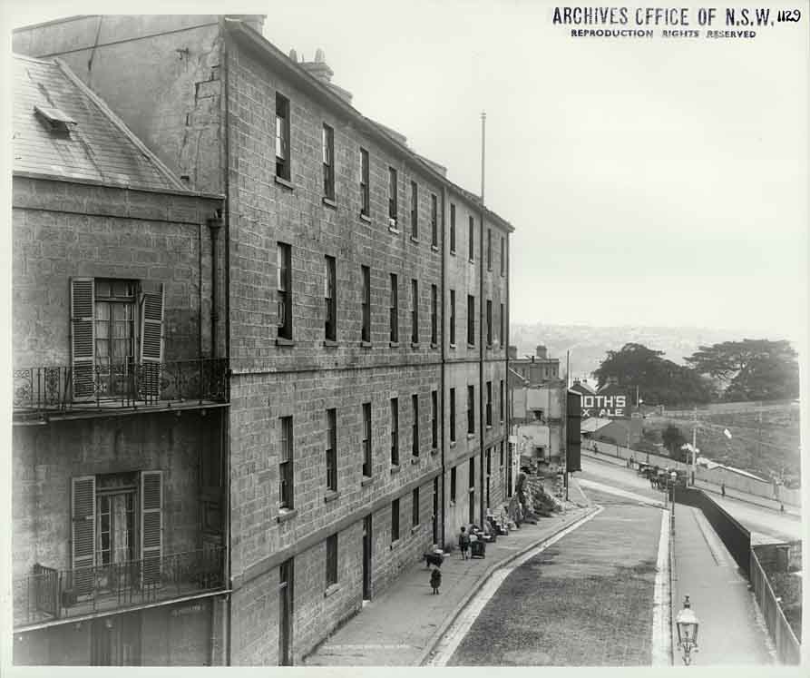
Bricks and Stone from old Water Police Court

- beachcomber australia said:
- beachcomber australia said:
- beachcomber australia said:
- Dictionary of Sydney said:
A battery of 1,000 and 2,000 pound furnaces roaring threats to the Axis. These are rotary, oil-fired melting furnaces at Aluminum Industries Inc. Destination of the finished aluminum products is kept secret (LOC)

-
jdavis417 said:
Title: They Tested Our Mettle
-
bbgun06 said:
I like the caption on this one. A little patriotism added by the photographer...
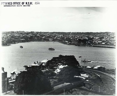
View from Observatory Hill, Sydney
- 1 older comment, and then…
-
beachcomber australia said:
See notes and comments here -

-
Museums of History NSW - State Archives Collection said:
John Cowper Thanks for identifying all these landmarks, you've been busy! AB
-
colinbm said:
The one marked Blues Point on the left is actually McMahons Point
-
Julie Storry said:
This was taken before 1911 beause the DP Baths is still in-situ. After 1911 it was replaced by Walsh Bay 1 (aka Pier-1).
-
Philip Cohen said:
This is NOT a view from "Observatory Hill"! It has to be from a point closer to and overlooking Dawes Point as, obviously, it is directly overlooking that Point; that's the northern most end of Lower Fort Street in the left foreground; it's more likely taken from the top of the old Miles building in Gloucester Street … s3-ap-southeast-2.amazonaws.com/nswsa-content/images/4481...