lock
20 photos and 14 illustrations tagged lock, from 8 members of Flickr Commons.
When were these photos & illustrations taken?
Where were these photos & illustrations tagged?
35% of these photos & illustrations are geotagged.
Related tags
Tags that often appear on the same photos & illustrations:
- bldigital
- publicdomain
- mechanicalcurator
- nationallibraryofireland
- pubplacelondon
- vol0
- canal
- small
- bridge
- ireland
- sherlocknet:category=objects
- sherlocknet:tag=house
- key
- leinster
- large
- sherlocknet:tag=street
- sherlocknet:category=landscapes
- sherlocknet:tag=form
- glassnegative
- elinorwiltshire
- rolleiflexcamera
- rolleiflex
- wiltshirephotographiccollection
- grandcanal
Members using this tag
- British Library
- National Library of Ireland on The Commons
- The Library of Congress
- U.S. National Archives
- Public Record Office of Northern Ireland
- DCPL Commons
- OSU Special Collections & Archives : Commons
- Bibliothèque de Toulouse
Photos & Illustrations
Show photos & illustrations photos (20) illustrations (14)
Photos & Illustrations tagged lock:
Loading photos & illustrations…
Recent uploads
The last upload was March 2019.
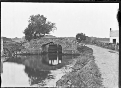
Third Lock, River Lagan, Belfast, Co. Antrim from National Library of Ireland on The Commons uploaded January 2019

The centre of Ireland from National Library of Ireland on The Commons uploaded September 2018

Boyne Valley: Lake House, Boyne Valley, Co. Louth from National Library of Ireland on The Commons uploaded February 2017

British Library digitised image from page 191 of "The Story of a Feather" from British Library uploaded July 2016

Navan (An Uaimh), Co. Meath, Ireland from National Library of Ireland on The Commons uploaded February 2015

British Library digitised image from page 400 of "British Battles on Land and Sea" from British Library uploaded December 2013

British Library digitised image from page 161 of "Rambles in Galloway. (Second edition.) L.P" from British Library uploaded December 2013


Conversations
Here’s a selection of the conversations happening on these photos & illustrations:
Killeen's Lock, Killaloe, Clare

- Niall McAuley said:
- Probable Ice said:
- Suck Diesel said:
Along the Danube Canal In the Very Heart of Vienna.

-
muhsin atcı said:
fantastic composition. Congarts.
Traffic Jam

- 11 older comments, and then…
-
Niall McAuley said:
Despite the title, this is not a canal lock, it's the lock at the weir on the Shannon at Athlone.
You can see the very same foreground stonework, water level (in that notch) and metal lock-gate-opening gizmo in my (relatively) recent photo, here:
-
National Library of Ireland on The Commons said:
Niall McAuley Thanks for saving our (my!) blushes there. Have changed description, and in return, can tell you that the gizmo is officially a gate winch... So is that the canal at all?
-
Niall McAuley said:
No, it's just that lock you can see in the photo above, there's no canal at all. See an aerial view from Google maps linked below, the lock is to the left of the weir: maps.google.ie/maps?hl=en&ll=53.422947,-7.939392&...
-
National Library of Ireland on The Commons said:
Niall McAuley Thanks! Obliterated all mention of canal from tags...
-
Stuart said:
Here's one of the gate winches without it's coverings and a close up of a plate inscription from another. You can see the winch could have been operated by one or two people and it originally used chains. Thomas Rhodes was Chief Engineer on the harbour project, the technical guy in charge.

