cúigelaighean
9 photos tagged cúigelaighean, from 1 member of Flickr Commons.
When were these photos taken?
Where were these photos tagged?
77% of these photos are geotagged.
Related tags
Tags that often appear on the same photos:
- nationallibraryofireland
- leinster
- ireland
- glassnegative
- 20thcentury
- robertfrench
- williamlawrence
- lawrencephotographcollection
- lawrencephotographicstudio
- louth
- contaelú
- laighin
- 1950s
- colouth
- theweecounty
- cocarlow
- carlow
- ceatharlach
- morganaerialphotographiccollection
- bw
- alexandercampbellmorgan
- captainacmorgan
- piperapache
- eiajl
Members using this tag
Photos
Photos tagged cúigelaighean:
Loading photos…
Recent uploads
The last upload was March 2025.

Louth Hospital from National Library of Ireland on The Commons uploaded March 2025

Towering above the town from National Library of Ireland on The Commons uploaded April 2021

Ireland’s answer to the Cerne Abbas Giant? from National Library of Ireland on The Commons uploaded April 2021

Spot the dog? from National Library of Ireland on The Commons uploaded April 2021

Snow in Wicklow from National Library of Ireland on The Commons uploaded April 2021

Mr. Gray composing his elegy? from National Library of Ireland on The Commons uploaded April 2021

A handsome pair of Cats – The Murphys on their wedding day from National Library of Ireland on The Commons uploaded April 2021

Stylish Log cabins at Greenore from National Library of Ireland on The Commons uploaded March 2021

Old stones and winding roads... from National Library of Ireland on The Commons uploaded March 2021
Conversations
Here’s a selection of the conversations happening on these photos:
Towering above the town
- 20 older comments, and then…
- Ilia Alshanetsky said:
- beachcomber australia said:
- George FitzPatrick said:
- beachcomber australia said:
- George FitzPatrick said:
Ireland’s answer to the Cerne Abbas Giant?
- 7 older comments, and then…
-
CASSIDY PHOTOGRAPHY said:
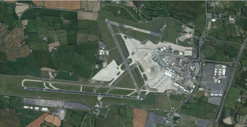
Look more like an airport these days- www.dublinairport.com/images/default-source/cip-2020-imag...
-
Rory Sherlock said:
Here's a Streetview from St Clare's Road at the centre - one can rotate to look down the twin roads of Pearse Road (with the grassed rectangles in the middle) and then rotate again to see the curving line of houses on Staunton Avenue: www.google.com/maps/@52.8399914,-6.9416993,3a,75y,104.56h...
-
George FitzPatrick said:
Modified herring bone pattern in field is for land drainage. What I can't see are the terracotta clay pipes. Maybe they have been laid and are awaiting to be back filled. The heaps along the headland look to be stone to be laid over the pipes.
-
Rory Sherlock said:
That's Graiguecullen GAA pitch bottom right - drainage works underway... And Carlow Castle is visible across the river in the background
-
George FitzPatrick said:
www.flickr.com/photos/89316281@N04/41185593912/in/photoli...
Snow in Wicklow
- 8 older comments, and then…
-
National Library of Ireland on The Commons said:
beachcomber australia Sharon Corbet Deja vu - you must be kidding :-)
-
O Mac said:
Looks like Glenmacnass between Laragh and Sally Gap. That being the old military road. R115 maps.app.goo.gl/MuF3vC4CjM2fRbAF7
-
Foxglove said:
I am surr this was a river scene at 9/15 or was the image so calming that I am now floating above it all
-
beachcomber australia said:
National Library of Ireland on The Commons I must have been dreaming, or April Fool's is a week late. Or Monkey business!
-
Suck Diesel said:
The Military Rd per Wiki en.wikipedia.org/wiki/R115_road_(Ireland) Includes some equally snowy scenes from ground level. At leat it starts from a more civilised location, i.e. the Yellow House pub in Rathfarnham.