countygalway
41 photos and 4 illustrations tagged countygalway, from 2 members of Flickr Commons.
When were these photos & illustrations taken?
Where were these photos & illustrations tagged?
84% of these photos & illustrations are geotagged.
Related tags
Tags that often appear on the same photos & illustrations:
- nationallibraryofireland
- glassnegative
- williamlawrence
- lawrencephotographcollection
- ireland
- robertfrench
- lawrencephotographicstudio
- connacht
- dillonfamily
- augustacarolinedillon
- connemara
- lukegeralddillon
- locationidentified
- baronessclonbrock
- nationalphotographicarchive
- clonbrockphotographiccollection
- baronclonbrock
- galway
- ahascragh
- church
- clifden
- 20thcentury
- cogalway
- publicdomain
Members using this tag
Photos & Illustrations
Show photos & illustrations photos (41) illustrations (4)
Photos & Illustrations tagged countygalway:
Loading photos & illustrations…
Recent uploads
The last upload was 27 August.

Inches to the foot - Perches to the acre! from National Library of Ireland on The Commons uploaded 27 August

Yes Maam from National Library of Ireland on The Commons uploaded 3 July

Blessed are the Merciful from National Library of Ireland on The Commons uploaded 11 June

You'll get a needle to an anchor in Paddy Browne's from National Library of Ireland on The Commons uploaded March 2026

Islands in the mist from National Library of Ireland on The Commons uploaded December 2025

A marriage of the Eras in County Galway from National Library of Ireland on The Commons uploaded November 2025

The Pipes, the Pipes are calling from National Library of Ireland on The Commons uploaded May 2025

Rocking around Connemara from National Library of Ireland on The Commons uploaded December 2023

Hoops, boots and statues from National Library of Ireland on The Commons uploaded July 2023
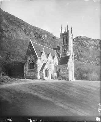
The High and the Almighty from National Library of Ireland on The Commons uploaded April 2023

Walking the plank for the Nuns? from National Library of Ireland on The Commons uploaded April 2023

All standing still in Clifden! from National Library of Ireland on The Commons uploaded December 2022

A dry stone wall to hold back the tide? from National Library of Ireland on The Commons uploaded November 2021

Laying the foundations for a new pier. But where? from National Library of Ireland on The Commons uploaded June 2019

Only the donkey knows how to pose! from National Library of Ireland on The Commons uploaded May 2019
Conversations
Here’s a selection of the conversations happening on these photos & illustrations:
Hoops, boots and statues
- 22 older comments, and then…
- O Mac said:
- beachcomber australia said:
- Carol Maddock said:
- Carol Maddock said:
- beachcomber australia said:
All standing still in Clifden!
- 21 older comments, and then…
-
beachcomber australia said:
Hmm - there is a church steeple missing, seen in a later ("c. 1910") photo -
.jpg/1200px-CIE_no._589_(44704220350).jpg) From - en.wikipedia.org/wiki/Clifden_railway_station
From - en.wikipedia.org/wiki/Clifden_railway_station -
beachcomber australia said:
St Joseph's Church - "In 1898 the Church Spire was completed standing at a height of 150 feet." - www.clifdenparish.com/clifden-history/ Station opened 1/1/1895 (see wiki above). So 1895 - 1898, so far ...
-
Suck Diesel said:
beachcomber australia Re the Wiki pix, post 1925 as it now sports a GSR number
-
Suck Diesel said:
Loco is no. 26, which I can’t just trace at the moment. Station operated 1895 - 1935
-
Niall McAuley said:
Galway to Clifden railway opened in 1895. Everything looks very fresh here, I'd say we are not too far from the opening.
Only the donkey knows how to pose!
- 8 older comments, and then…
-
Rory Sherlock said:
Galway - the building on the right is now the Town Hall Theatre and the bridge in the background is the old railway bridge which connected the mainline station (now Ceannt Station) to the Clifden line. www.google.ie/maps/@53.2760264,-9.054345,3a,75y,6.51h,95....
-
Carol Maddock said:
Rory Sherlock Ooooh, bualadh bos!
-
Fred Dean Snr. said:
The line closed April 1935.
-
Niall McAuley said:
Neither the courthouse nor the railway viaduct narrow the dates from 1900-1920.
-
beachcomber australia said:
We were nearby (a month ago) in January 1901, when there were renovations going on behind the central pillars -
 The new windows and doors are looking a little worn in the top photo, so probably a while after 1901 ?
I thought this might be before the 1901 renovations, but no; the original facade was more handsome - catalogue.nli.ie/Record/vtls000335983
The new windows and doors are looking a little worn in the top photo, so probably a while after 1901 ?
I thought this might be before the 1901 renovations, but no; the original facade was more handsome - catalogue.nli.ie/Record/vtls000335983